
Search Holland Streets by Address
Start with Ottawa County's property form when the address is in Holland or nearby township territory. A full address search produces a parcel path, not a complete household list. Save the property address, owner name, mailing address, final parcel identification number, legal description, sale and split history, values, and government unit. Those details make it possible to separate a physical site from the name used for tax correspondence. They also give later searches something more stable than a street spelling.
For a current Holland street directory search, work from the smallest confirmed fact outward. The county map shows parcel geometry and nearby parcels. The Register of Deeds connects a parcel or party to recorded transfers. Historic street indexes can add an earlier named household, while a public Qualified Voter File request has a different, written process. None of these sources proves that every person at an address is present now.
- Enter the house number and street name in Ottawa Real Property Search, then preserve the active or inactive parcel result that fits the address history.
- Open the related parcel in the county GIS service. Record the PIN, legal description, government unit, and the distinction between property and mailing addresses.
- Use the PIN, legal description, owner name, recording date, or instrument number in the Register of Deeds index to follow a transfer.
- For a voting-record question, use the Michigan Department of State QVF request route by jurisdiction, ward, precinct, or district rather than expecting an open block list.
- For an earlier Holland address, use Herrick's criss-cross street index and compare the result with a newspaper, census, deed, or permit date.
Use Holland Parcel Form Fields
Ottawa Real Property Search accepts an owner last name, a parcel number, or the house-number and street-name path. The form has no public ZIP field. Its five-part parcel entry needs the number preserved exactly, including leading zeroes, and the active or inactive choice matters when a lot was split, merged, retired, or otherwise changed. The resulting property summary can lead to values, tax description, sale history, split history, a parcel report, delinquent-tax material, and GIS.
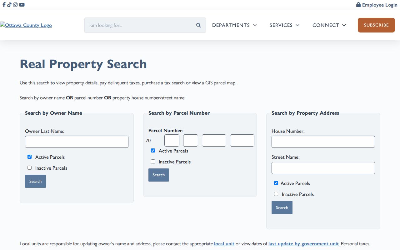
The image shows why an address should be entered as separate number and street fields. A Holland street result is best treated as an address-keyed property record, then checked against its mapped parcel and recorded-document history.
| Property-search field | Input | Required | How it helps |
|---|---|---|---|
| Owner Last Name | Text | No | Finds parcel cards by owner surname or business name. |
| Parcel Number | Five segmented fields | No | Provides the precise PIN route and retains parcel history. |
| House Number | Text or number | No | Starts the address route when paired with Street Name. |
| Street Name | Text | No | Completes the address route; ZIP is not exposed here. |
| Active or Inactive Parcels | Choice | No | Separates current parcels from split, merged, or retired records. |
Read Holland Situs and Mailing Fields
County GIS exposes both the situs, meaning the physical property address, and the mailing address used for tax correspondence. It also exposes owner, final, parent, and condominium PINs; condo name and unit; legal description; school district; property class; government unit; values; acreage; and Principal Residence Exemption, often shortened to PRE. A mailing address can belong to an owner, trust, business office, or another address. PRE can be a useful clue, but it is not a current-resident list.
- Parcel
- A mapped unit of land identified by a PIN for property-tax and land-record purposes.
- Situs address
- The physical Holland location of the parcel, distinct from where tax mail is sent.
- Plat
- A recorded subdivision map that can connect a lot and block to its legal description.
- Criss-cross directory
- A historical street-and-house-number index that is searched by address rather than surname.
Keep the property and mailing fields side by side in research notes. That simple step prevents a common error: treating a tax contact or recorded owner as proof of present residence along a Holland street.
Browse Holland Street Parcels on GIS
The Ottawa public parcel GIS service is the place to inspect a selected polygon and the parcels beside it. It supports query, advanced query, statistics, and query-with-distance functions. In the public map, zoom to the address or property link, select a parcel polygon, then inspect visible neighboring polygons. The public information did not expose a specific map-button name for a radius search, so use only functions visible in the live viewer.
Holland's city GIS adds a “Do I Live in the City?” check. Use that along with the county layer's Government Unit field. A Holland mailing address may sit in Holland Township, Park Township, Olive Township, or another local unit. School and zoning fields add geographic context, but they do not turn a parcel record into a street household roster.
Turn a Holland PIN into Deeds
Once an address has a PIN and legal description, the Ottawa Register of Deeds document search offers name, date range and document-type, liber and page, instrument number, and segmented parcel paths. The menu includes deeds, mortgages, liens, land contracts, leases, easements, foreclosures, plats, condominium records, surveys, and related instruments. Search the current owner as a grantee or party, note the purchase instrument, then use the prior party and the same legal description to move backward.
The index is free to search. Viewing, printing, or saving an image costs $1 per page plus a convenience fee. A search returns no more than 200 results, which is why a broad name should be narrowed by date, document type, middle initial, business name, parcel, or legal description. The online start year is not stated. Older material may require the Register of Deeds research counter or the Archives of Michigan, even though county restoration work reaches records back to 1836.
Check Holland Permits by Address
Holland Permit Search directs the public to the city BS&A route, where address, owner, or permit number are confirmed search choices. The city gives examples such as PBD100280 and PBD10, and the last two digits of the PBD number identify the year. A permit can supply dated work or ownership context, but the static instructions did not expose a complete result-field inventory or a historical coverage start date.
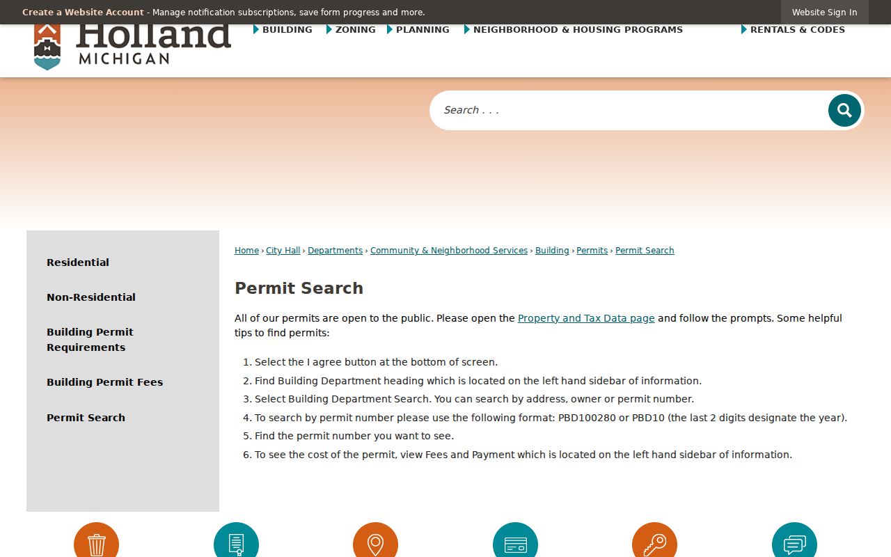
When an online permit result is too thin, Community & Neighborhood Services or a narrowly written city FOIA request is the documented fallback for an existing file. Preserve the address, date range, permit number if known, and parcel details so the request describes a record rather than asking for a new compilation.
Check Holland City Property Data
Holland's Property Search points to city BS&A information that advertises tax details, special assessments, recent sales history, building sketches, and photos for properties in the City of Holland. Its live vendor form is dynamic, so a detailed field list or a ZIP-wide control should not be assumed from the city instructions. Use the city source as a second property view, not a replacement for the county parcel and deed trail.
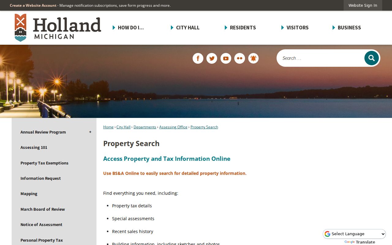
The city property view can add building and tax context to a Holland address. Compare it against the county PIN and legal description before carrying a name or sale detail into another record system.
Compare Holland Street Records
Each Holland street directory source answers a narrower question. The property roll identifies a parcel and reported owner. GIS adds geometry and local-unit fields. Recorded documents date a transfer or encumbrance. Permits can date work. A QVF release is governed by its request form. Keeping those roles separate makes an address trail more reliable and avoids turning one record into a claim it cannot support.
| Address-keyed source | Custodian | What it can show | Access route |
|---|---|---|---|
| Property roll | Ottawa Equalization and local unit | Owner, situs, mailing, PIN, values, PRE, legal description, sales and splits | miOttawa search and local-unit correction route |
| Public parcel GIS | Ottawa GIS | Polygon, adjoining parcels, owner, address, government unit, school and property fields | Public map and service |
| Recorded-document index | Ottawa County Clerk/Register of Deeds | Parties, instrument, type, date, liber/page, parcel, and image route | Free index; paid image access; counter for older work |
| Building permits | Holland Community & Neighborhood Services | Address, owner, permit-number, and dated-work context | Public BS&A instructions or city FOIA fallback |
| QVF public data | Michigan Department of State | Permitted registration fields by selected geography | Written QVF request; protected fields withheld |
| Street directories | Herrick District Library and partner collections | Historical householder, business, phone, or address clues by volume | Library and historical collections |
Handle Holland Street Boundaries
Holland was laid out on a traditional grid that remains useful for orientation, but street continuity has traps. Parcel splits, condominium units, city and township boundaries, postal geography, and changes in civic jurisdiction can all affect a record trail. The original plat and later development do not justify assuming that a familiar house number has always meant the same land area. A documented citywide renumbering year was not located in the research.
Use the legal description, lot or block, plat name, PIN lineage, neighboring intersections, and tax year to bridge uncertainty. The historic grid is helpful, yet the legal description outranks an unchanged number when a Holland address has been altered. City address-assignment records can be a useful fallback for a specific disputed address.
Read Holland Street Directories Backward
Herrick's Holland City Directory catalog begins in 1894, but the record does not prove annual publication. Documented local volumes include 1897-98, 1901-02, 1903-04, 1908, 1913-14, and 1924-25. The street or criss-cross index is the useful route when a researcher has a house number first. It can reveal a first-listed person, business, phone, or move notation depending on the volume.
For an earlier household, preserve the exact printed street spelling and house number, then compare a directory result with a deed, census, obituary, or newspaper notice. The historical collections themselves are described in more detail in the Holland city directories. A missing entry is not proof that no one was connected with the address, because coverage and listing practices vary by volume.
Use Holland Sanborn Street Sheets
The Library of Congress 1908 Holland Sanborn map has 28 digitized sheets. Sanborn maps describe structures, not occupants. After locating a street on the index, compare intersections, building footprint, use, materials, and number of floors with later parcel or permit evidence. Holland references also identify Sanborn material for 1883, 1889, 1896, 1902, and 1948.
The 1871 fire is a key continuity warning. A deed or tax item can refer to a lot before the standing building shown on a later sheet was constructed. Pair maps with the PIN and legal description instead of treating a street name alone as proof of the same structure.
Request Holland Street QVF Data
Michigan law requires a statewide street-address index inside the Qualified Voter File, but that does not create an open public block search. A written Michigan Department of State request can be selected by jurisdiction, ward, precinct, or district. A permitted release may include name, residential address, mailing address when available, birth year, registration date, status, voter ID, and history when requested and available.
Month and day of birth, phone number, email, signature, driver or state ID number, and the last four digits of a Social Security number are not released through that route. A QVF result also cannot prove that every person living on a Holland street is registered or currently there. Treat it as a limited election record and confirm geography with the local clerk when necessary.
Limit a Holland Street Directory
A public parcel search does not identify all household members. Mailing fields and PRE do not establish current presence. Driver-record addresses, utility accounts, delivery information, private lists, and protected Address Confidentiality Program residences are not open substitutes for these records. Michigan's Address Confidentiality Program uses a designated address for eligible participants, and public sources must not be used to work around that protection.
Record errors should go to the office that holds the source record. For a parcel issue, retain the PIN, result date, and disputed field for the local unit or county correction path. A deed, permit, election, or city file has its own custodian and correction process.