
Holland Neighbors by Block
Public records answer narrow questions about a Holland block. The Ottawa parcel layer is the best starting point because it shows parcel polygons beside the parcel number, situs address, mailing address, owner, legal description, government unit, and other property fields. A deed can explain a recorded transfer. A QVF request can return defined public registration fields. Neighborhood groups add a community contact route, not a member roster.
Start with the address, then keep each record in its proper lane. Parcel and tax data describe property ownership. A property mailing address may belong to a person elsewhere. Registered-voter fields describe registration when lawfully released. Neither source proves all residents of a building or block.
| Block source | What it shows | How to use it |
|---|---|---|
| Ottawa public parcel GIS | Adjacent polygons, PIN, owner, situs, mailing, legal and government-unit fields | Select and compare individual parcels |
| Ottawa property search | Address, owner, parcel summaries, and sale or split links | Anchor the first parcel |
| Register of Deeds index | Recorded transfers and encumbrances by parcel or legal description | Follow a dated ownership trail |
| QVF public file | Released registration fields by jurisdiction, ward, precinct, or district | Written Michigan request; protected fields withheld |
| Neighborhood resources | Area names and community contacts | Use for community context, not identities |
Note: A geographically adjacent parcel may not be on the same civic block face or in the same neighborhood area.
Map a Holland Neighbor Block
Use the Ottawa County parcel map as a controlled walk around an address. The public layer supports polygon browsing and spatial queries, although the exact public-map controls for a distance search were not captured in the research. Do not assume that every polygon touching the first parcel belongs in the same social or civic area. Roads, alleys, rail lines, water, and corner frontage can change how people describe a block.
- Search the address in Ottawa property search and open its GIS map. Save the selected parcel’s Final PIN and legal description before moving on.
- Read the selected popup’s owner, property address, and mailing-address fields. Keep the situs and mailing details separate.
- Pan or click to inspect parcels on both sides, behind the parcel, at a corner, and across the street. Compare street direction, suffix, house number, and unit clues.
- Open the property summary or deed index for a neighboring PIN when a recorded transfer matters. An owner can hold several adjoining parcels through one name or company.
- Check the government-unit field and the City of Holland “Do I Live in the City?” tool before assigning a city or township label.
This process is deliberately narrower than a whole-street search. For a full address-by-address record chain, use the Holland street address directory after the immediate block is mapped.
Holland Parcel Clues Need Context
A named owner and a principal residence exemption do not prove who occupies a Holland address. The parcel record is designed for property, tax, and assessment work. It may show a situs address, a different mailing address, a legal description, and value fields. A vacant parcel, a shared ownership arrangement, a trust, or a company can make a simple name-to-door assumption wrong.
The QVF has a statewide street-address index and precinct data, but public release remains a written request with defined fields. A request can be narrowed by jurisdiction, ward, precinct, or district. Public results may include residential and mailing address, birth year, registration date, status, and voter history where available. Month and day of birth, phone, email, signature, state ID, driver information, and Social Security details are withheld.
Common mistake. An owner field, tax mailing address, or principal-residence flag is not proof of the people living at a Holland parcel. Treat each as a limited record fact.
Holland Neighborhood Connections
Holland Neighborhood Connections describes five organizations across six areas. The material available for this build names the groups below and their local contact paths. They are useful connectors for events, area questions, and community context. They do not publish a public member directory, so a group contact should never be used to create one.
| Community connector | Areas named in local material | Contact detail |
|---|---|---|
| 3Sixty | Eastcore, Montello Park, West of Washington | Community hub at 27 W. 16th Street |
| Heights of Hope | SOAR, Stratford Way, Abbey Court, Oxford Court, Country Lane | Use the organization’s community contact route |
| Washington School Neighbors | Washington School and Historic | Use the organization’s neighborhood contact route |
| Westcore Neighbors | Washington Square and Westcore | Nuestra Casa, 253 W. 15th Street; hello@westcoreneighbors.org |
City material describes a shared asset-based approach and an additional connector relationship, but the research retained no separate name or contact for it. The named contacts above are community connections, not sources for household information.
Holland Neighborhood Map Terms
The city’s neighborhood descriptions and guides name Downtown, Historic, Holland Heights, Hope, Maplewood, Rosa Parks, Washington Square, and Westside. These names help a person describe an area, but they are not parcel boundaries or lists of residents. Pair a neighborhood name with the parcel’s government unit, street, PIN, and city-limit check.
This matters around Holland because a postal address may point to the City of Holland, Holland Township, Park Township, Olive Township, or another government unit. The city’s GIS separates city geography from the countywide map. A map label alone should not decide which public office holds a property, permit, or civic record.
Note: Preserve the government-unit field with the PIN whenever a Holland-area address is near a city or township boundary.
Narrow Holland Status Searches
Some official status tools are commonly misunderstood as a way to list neighbors. They are not. The Ottawa County custody search is limited to people currently in custody and requires a complete last name, with optional first-name, date, and gender filters. An arrest is not a conviction, and the result does not establish residence or describe a whole block.
Ottawa County’s current-in-custody search is a narrow status tool with its own search rules.
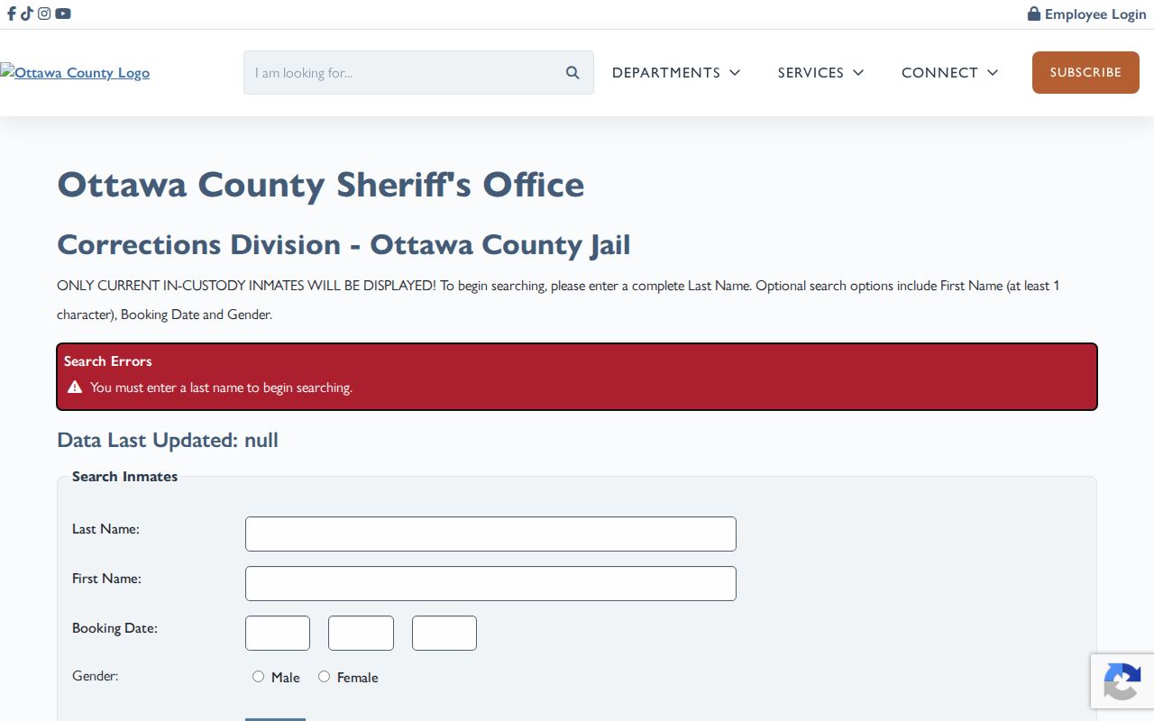
Its required-name approach shows why a custody page cannot function as a Holland neighbors roster or an address search.
Michigan’s public sex offender registry offers name, address, city, county, ZIP, and radius modes under its own legal notices.
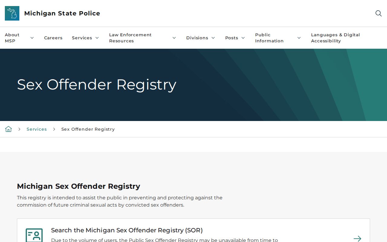
The registry is not a universal neighborhood list and does not provide victim information. Use only the official search modes and restrictions stated by the agency.
Holland Block History Evidence
Deeds and permits add dates to a block without identifying every person who was present there. A recorded deed links grantor, grantee, document date, and legal description. Holland’s permit search accepts an address, owner, or permit number. When a particular existing record is needed and the online result is not enough, a focused city or county records request can name the address, date range, and file type.
For an older block, Herrick’s local city-directory catalog begins in 1894 and its street indexes can pair a house number with a historical head of household, depending on the volume. The city directories are historical snapshots. Compare their date with the deed, tax record, newspaper, or cemetery evidence rather than treating an old listing as current.
Herrick’s Holland City Directory catalog is an in-library collection, not a promise of annual coverage. Its documented local volumes include different publishers and years. Read the street index, when present, with the volume’s date and abbreviation key. A house number, owner or renter mark, phone listing, or move notation can supply a dated lead, but every field depends on that particular directory’s format.
Official and Commercial Neighbor Lists
Official records show their custodian, scope, and correction path. Commercial neighbor-list products combine data from different sources and may be stale, duplicated, mismatched, or incomplete. They can be a prompt to verify a public record, but they do not replace the local office that holds the original property, court, vital, or voter record.
| Source category | Strength | Limit and correction route |
|---|---|---|
| Official parcel or deed record | Shows the local recorded ownership or document trail | Does not establish every occupant; ask the custodian about an error |
| QVF public-file request | Provides only released registration fields under Michigan rules | Not an open contact list; protected fields and participants are excluded |
| Commercial people-list category | May collect leads from varied data sources | Can be stale or mismatched; follow its opt-out process and verify with the originating custodian |
Holland Block Privacy Limits
Several facts about a block are not public neighbor data: household members not named in a lawful record, the actual occupant when a mailing address differs, utility accounts, deliveries, private rosters, and personal contact details. Michigan’s Address Confidentiality Program protects qualifying people with a substitute address. Michigan driver-address information is restricted by MCL 257.208c and is not available through a public-record request.
Public availability never grants permission to pursue someone. Michigan’s stalking law covers repeated unwanted conduct that causes fear or harassment. If a record seems wrong, preserve the source and date, then ask the originating office about its correction process instead of repeating an unverified claim.
Lawful personal use. Holland neighbor research is for personal curiosity, community context, and careful public-record verification. Never use an address, map, or record to stalk, harass, intimidate, or harm anyone.